MAPPING OXFORD – A NEW ATLAS

MAPPING OXFORD – A NEW ATLAS
From a henge monument around Keble to 1640s Royalist defence works, a major new historical atlas of Oxford has thrown up some surprises, says Julian Munby.
Published: 31 January 2023
Author: Julian Munby
Share this article
The map image of Oxford has long been familiar — from Ralph Agas’s bird’s-eye view of 1578 to the OUP plastic relief map of the 1960s, to everybody’s go-to reference for museums, restaurants and car parks in the form of Google Maps. Residents of Oxford become familiar with the paths to its meadows and surrounding hills, while visitors have to navigate less obvious routes round a ‘University’ that does not itself appear on any map.
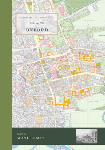
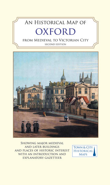
The British Historic Towns Atlas volume on Oxford and the separate by adjacent Historical Map of Oxford present a mixture of reassuring familiarity and surprise. You haven’t seen the city before quite like this.
The volume is the latest contribution to a pan-European project, established in 1955, to provide detailed maps, in an agreed format, of the historic towns of Europe. The project has seen the production of around 500 atlases of towns from Ireland to Ukraine.
The Oxford volume, accompanied by the publication of a historical sheet map, is the latest of a series covering British towns, including York and Winchester published by the Historic Towns Trust. It has been produced in an attractive large-format folder which contains a volume of introductory text, and 27 printed sheets at A2 size including: a summary historical map in several sheets; a series of period maps of Oxford, of its environs and boundaries; copies of historic maps; and a large number of historic views of Oxford, many of which are unfamiliar.

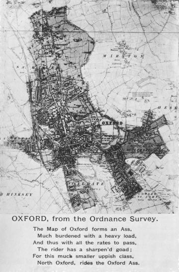
The main historical map is based on the Ordnance Survey 25-inch map (1:2500) of 1876. The map has been selectively redrawn and historical features, both extant in 1876 and vanished, have been added and public building and institutions are highlighted. A distinction is made between medieval and later buildings, and the mapping locates lost buildings such as the medieval castle, the friaries and monastic remains, the Carfax conduit, the workhouse in Wellington Square and even the odd lost college — Canterbury College was subsumed by Christ Church, for example.
The period maps show Oxford in each century between 1050 and 1800, while the reproductions of some of Oxford’s earlier maps include those of Agas 1578, Wenceslaus Hollar 1643, David Loggan 1675, William Williams 1733, Isaac Taylor 1750, J. Whessell 1831, and Robert Hoggar 1850.
Manuscript maps reproduced in colour include Christ Church’s remarkable map of the castle, its ditch and surrounding earthworks c.1617, and St John’s College’s detailed map of St Giles fields in 1769 which became its North Oxford development in the 19th century.
The historical text is edited by Alan Crossley (St John’s, 1959) who was, for many years, editor of the Oxfordshire Victoria County History and the City of Oxford volume published in 1975. Separate contributors give substantial accounts of Oxford’s setting and geology, the prehistoric and Roman background, the Saxon and medieval town, and early-modern and modern Oxford. Amongst the text figures can be found maps of the Saxon defences, medieval academic halls and inns, street names, the origins of Oxford’s apprentices, and the growth of the city.
Oxford antiquaries have been mapping the town since the 17th century. Anthony Wood was not the first to try and locate the numerous academic halls in which the majority of students lived, but by getting the engraver and topographer David Loggan to illustrate his History of the University (1674), Wood inspired the greatest of all Oxford (indeed European) town plans: Loggan’s astonishingly detailed bird’s-eye view of 1675 which is such a delight to explore. In transferring the detail from Loggan’s map onto a modern base for the atlas, it became evident that Loggan accurately observed and captured many topographical features (some quite minor) which survived well into the modern age, and indeed can still be seen on the ground.
Even for those familiar with the topography of the town, the very act of mapping it at different periods in its history has stimulated further inquiry, requiring a balance between doubt and certainty. The act of converting sometimes sketchy knowledge and understanding of a historical feature to a symbol on a map requires constant decisions to be made about its location, extent and shape, when often the degree of certainty about all three is very variable.

Even during the period of editorial production of the atlas, archaeological discoveries continued to provide key information and upset fondly held beliefs.
For example, understanding of the prehistoric landscape has been transformed by the discovery of a henge monument encircling Keble College which gives a context to the numerous barrow burials that have been encountered in its environs, especially in the University Parks.
Roman Oxford has resolutely remained a mere village or hamlet, overshadowed by industrial-scale pottery works in Cowley and Headington. But, while much has been discovered of Anglo-Saxon Oxford, such as the continuity of the town wall around Oxford Castle (and the likelihood that St George’s Tower was already standing when Robert D’Oilly came to build the castle after the Norman Conquest), a great deal of uncertainty remains about pre-Conquest Oxford including the shape of the defended borough founded somewhere around AD 900, the location of primary routes into the town, and its ecclesiastical history. Ongoing debates on these matters, reflected in the text, will continue to be discussed as further evidence accumulates.
Even more lively was the archaeological dynamic of the gradual uncovering of evidence for the Civil War defences surrounding the royalist capital in the 1640s.
These were mapped in detail during siege preparations by Bernard de Gomme, showing old, new, and proposed works. The remains of the ramparts and ditches survived in many places to be mapped by Loggan in 1675 and can be traced on the OS map of 1876 as used for the atlas. The preparation of a map of these defences for the atlas fortuitously coincided with a whole series of archaeological investigations on the north and west sides of Oxford that resulted in a map which evolved until the last minute before publication.
For later periods, as well as the maps created especially for the atlas, it is the copies of historic maps and topographical drawings that should delight readers and provide surprises for those who thought they knew the town well.
Hard choices had to be made in selecting from the wealth of drawings, prints, and photographs from one of England's most illustrated places where the producers of antiquarian, picturesque, and nostalgic views have been hard at work since the 17th century.
The British Historic Towns Atlas, Volume VII, Oxford. Edited by Alan Crossley. Oxbow Books for the Historic Towns Trust. ISBN: 978-1-78925-326-9
An Historical Map of Oxford. Edited by Alan Crossley. 2nd edition. The Historic Towns Trust. ISBN: 978-0-9934698-9-3


